
Mississippians living in low-lying areas along the Gulf Coast must evacuate today as Hurricane Sally approaches. Weather experts predict that the area could see a storm surge as high as 11 feet.
The Biloxi Sun Herald reported the first mandatory evacuation yesterday evening, when the Hancock County Emergency Management Agency issued its order shortly after Gov. Tate Reeves declared a state of emergency on Sunday evening. The Hancock County Emergency Management Agency said in a press release this morning that the evacuation includes “residents living on rivers, river inlets, bayous, creeks, and in travel trailers, modular homes, mobile homes, homes under construction and or partially constructed homes.”
This afternoon, the Herald also reported that Harrison County ordered mandatory evacuations south of the seawall beginning at 1 p.m.
Jackson County is requesting that residents in low-lying areas evacuate voluntarily.
“If you live in low-lying areas, the time to get out is early (Monday) morning,” Reeves said during a press conference yesterday evening. “Do not try to get out at 3 or 4 o’clock in the morning Tuesday. At that point, it’s going to be too late.”
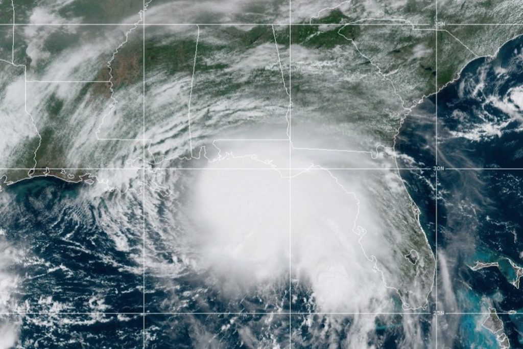
This morning, Reeves said the State now expects Sally to make landfall in Biloxi early Tuesday as a high category one storm. Some analysts expect Sally could reach category two status.
The Sun Herald has a list of shelters where Gulf Coast evacuees can go to ride out the storm.
Authorities have set up self-serve sandbag locations across the Mississippi Gulf Coast in Jackson, Harrison and Hancock counties.
The National Hurricane Center says Hurricane Sally could be a category-two storm when it arrives on land in the Gulf Coast early Tuesday morning.
On its Twitter account yesterday evening, the NHC warned that “life-threatening storm surges” are possible.
“Dangerous hurricane-force winds are expected by late Monday somewhere within the Hurricane Warning area between Morgan City, LA and Ocean Springs, MS, including New Orleans, with tropical storm conditions beginning on Monday,” the NHC tweeted.
During his emergency press conference on Sunday evening, Gov. Reeves said that south Mississippi counties should expect 10 inches of rain as far inland as Hattiesburg in Forrest County, about an hour and a half from the coast, and that there is a “high probability” that the storm will spawn tornadoes, he said.