
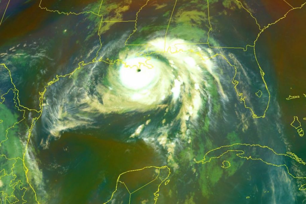
A powerful storm surge is flooding the Mississippi Gulf Coast as Hurricane Ida, a category 4 storm with winds speed of about 150 miles per hour, made landfall in Port Fourchon, La., this morning at 11:55 a.m. central standard time. Ida’s strength dwarfs that of Hurricane Katrina, which arrived on the Gulf Coast 16 years ago today with wind speeds of 125 miles per hour, and the storm is expected to be the most powerful to hit the region since the mid-1800s.
Mississippi Gov. Tate Reeves issued a state of emergency declaration yesterday evening, with requests for federal emergency assistance for the Mississippi Band of Choctaw Indians and twenty-four south Mississippi counties.
“Your team is prepared and ready for whatever response is necessary,” Gov. Tate Reeves tweeted this morning after a meeting with the Mississippi Emergency Management Agency. “But we need you to prepare as (the) next 24-36 hours is going to be challenging throughout the state.”
The National Weather Service this morning described Ida as “an extremely dangerous category 4 hurricane.” Though the storm was expected to weaken after landfall in south Louisiana, Gov. Reeves said today that south Mississippi could experience hurricane-force winds in the coming hours as the storm moves into Mississippi from south of Natchez.
The National Weather Service said that the area along the coast between Bay St. Louis, Miss., and Ocean Springs, Miss., could experience storm s-rge heights today between 6 and 9 feet high.
“The combination of a dangerous storm surge and the tide will cause normally dry areas near the coast to be flooded by rising waters moving inland from the shoreline,” the alert said.
Even after the storm begins weakening as it moves across land, the alert says, “storm conditions will also spread inland over portions of Louisiana and Mississippi tonight and Monday” and tornadoes are possible through Monday across southwest Louisiana and southern Mississippi.
A tropical storm warning is currently in effect for the following Mississippi counties: A Tropical Storm Warning is in effect for Adams, Attala, Catahoula, Claiborne, Clarke, Concordia, Copiah, Covington, Forrest, Franklin, Hinds, Holmes, Humphreys, Issaquena, Jasper, Jefferson, Jefferson Davis, Jones, Lamar, Lawrence, Leake, Lincoln, Madison, Marion, Neshoba, Newton, Rankin, Scott, Sharkey, Simpson, Smith, Warren, Washington, and Yazoo.
“The storm is expected to move northward and slow down before turning more north-northeast, resulting in the potential for prolonged heavy rain and increased flash flooding potential across the region,” the National Weather Service says.
The National Weather Service in Jackson warns that south and central Mississippi face “life-threatening” dangers from wind, flooding rain and tornadoes.
“Now is the time to complete all preparations to protect life and property in accordance with your emergency plan. Ensure you are in a safe location before the onset of strong winds or possible flooding,” the alert says. “When making safety and preparedness decisions, do not focus on the exact forecast track since hazards such as flooding rain, damaging wind gusts, storm surge, and tornadoes extend well away from the center of the storm.”
The alert urges residents in the affected area to keep phones well charged but notes that while “cell phone charges can be helpful,” people should “be aware of your risk for deadly carbon monoxide poisoning if your car is left idling in a garage or other poorly ventilated area.”
“Failure to adequately shelter may result in serious injury or loss of life. Always heed the advice of local officials and comply with any orders that are issued. Remember, during the storm 9 1 1 Emergency Services may not be able to immediately respond if conditions are unsafe. This should be a big factor in your decision making,” the National Weather Service says.
Gov. Reeves’ pre-disaster emergency declaration seeks federal aid with FEMA authorized to provide emergency assistance in the following Mississippi counties: Adams, Amite, Covington, Forrest, Franklin, George, Greene, Hancock, Harrison, Jackson, Jefferson, Jefferson Davis, Jones, Lamar, Lawrence, Lincoln, Marion, Pearl River, Perry, Pike, Stone, Walthall, Wayne and Wilkinson Counties.
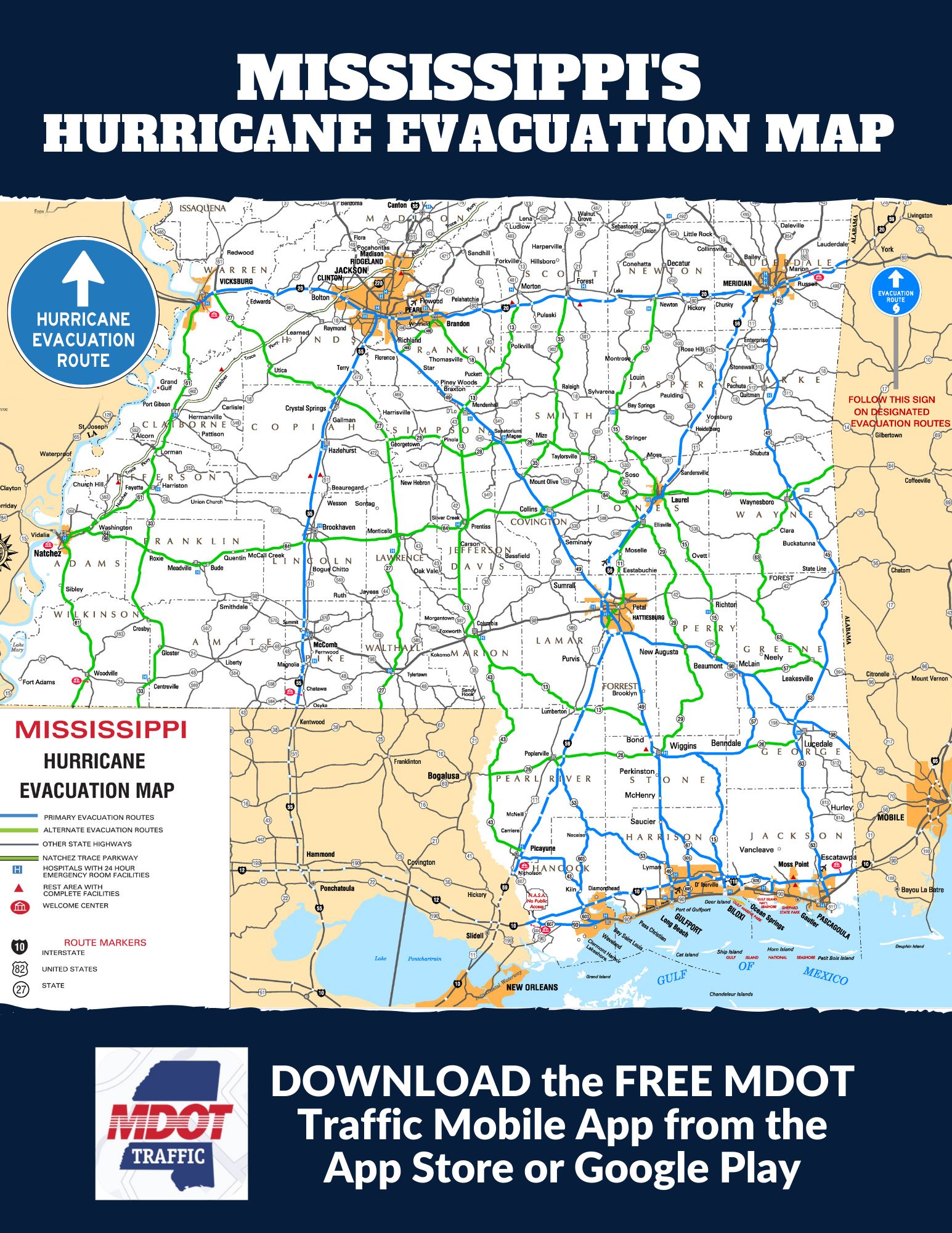
The Mississippi Emergency Management Agency urges residents to prepare for hurricanes “by developing a family emergency plan, learning evacuation routes and assembling a three to five-day disaster supply kit.”
MEMA says a kit should include a flashlight and battery-powered radio with extra batteries; canned and non-perishable food; bottled water; toiletry items; pet food and supplies; medicine and prescription medicine; copies of important family papers and documents; and personal protective equipment.
MEMA provides more hurricane preparedness information on its website, including evacuation routes and its 2021 Emergency Guide, which is also available in Spanish.


